INSTITUT NATIONAL DE LA RECHERCHE AGRONOMIQUE French National Institute for Agricultural Research
Description of organisation
INRA is the leading European agricultural research institute and one of the foremost institutes in the world for agriculture, food and the environment. It is also the second largest public research institute in France.
The research conducted at INRA concerns agriculture, food, nutrition and food safety, environment and land management, with particular emphasis on sustainable development.
Inra employs 1,800 researchers, 2,500 engineers, 4,000 technicians and administrative staff, nearly 2,000 PhD students and more than 1,800 foreign students and researchers at 18 regional locations.
Description of the unit participating in LANDMARK
INRA Unit InfoSol coordinates the implementation of the French Soil inventory (Inventaire, Gestion et Conservation des Sols – IGCS) and is responsible for the implementation and the harmonization of all soils survey projects and all soils databases for the French territory. Therefore it has a large experience on QA/QC procedures on soil databases. Numerous check rules have already been implemented for validation of soil data at the French level. The Infosol Unit also co-ordinates the monitoring programmes (Réseau de Mesures de la Qualité des Sols – RMQS). The RMQS is a network based on a 16x 16 km systematic grid covering the whole French territory. The RMQS includes 2200 monitoring sites, among which the 600 sites of the ICP forest level 1 European network, where a large range of soil parameters are monitored. All samples are archived in a soil conservatory under controlled hygrometric and temperature conditions. Its solid experience and reputation has led the InfoSol Unit to give methodological and technical assistance to other countries. During the last years, it has delivered a strong support to the development of pan-European databases. To carry out these various tasks, the InfoSol Unit has high-level experts covering many fields of expertise (soil science, survey and monitoring, agronomy, computer science, sampling design, advanced geo-statistics, spatial analysis and modelling) who can answer a wide range of demands. To assist these experts, a strong data processing team has developed numerous data management applications using the latest equipment and the most up-to-date software (e.g. web mapping, database management, data warehousing, statistics).
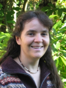
Members of the team :

